Yorkshire Multimodal Corridor Study
Background:
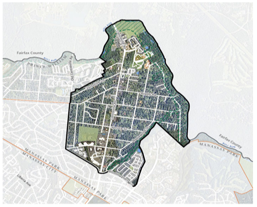
As Yorkshire’s main roadway, Virginia Route 28 plays a vital role as a county gateway and is a major transportation route through the center of the community. The 2023 Comprehensive Plan identifies Yorkshire as an Activity Center, or multimodal center. One of the primary characteristics of a multimodal center is maintaining a mixture of land uses consisting of localized centers of activity and density, including population, employment, or activities (retail, civic, or other activity-generating uses). The Comprehensive Plan targets future growth and the County anticipates multimodal centers will play a major role in achieving the goals set forth in the plan.
Route 28 is considered a Principal Arterial according to the PWC Design and Construction Manual (DCSM). A Principal Arterial is designed to accommodate through traffic, intra- and inter-county movement, as well as local traffic. Principal arterials are planned to include a sidewalk, and a shared use path for non-motorized traffic. Generally, traffic volume exceeds fifteen thousand (15,000) vehicles per day (vpd) and may carry bus routes. The challenge of the TLC grant will be to accommodate the traffic demands by offering alternative transportation modes such as transit, pedestrian or bicycle.

Transportation Land Use Connection Program:

The Transportation Land-use Connection Program (TLC) Program was established by the Washington Council of Governments Transportation Planning Board (WashCOG- TPB) in 2007 to provide short-term consultant services to local jurisdictions for small planning projects that promote mixed-use, walkable communities and support transportation alternatives. The program offers consultant assistance of $30,000 to $80,000 for planning projects or design projects, and up to $80,000 for design or preliminary engineering projects.
The final Yorkshire Transportation Land-use Connection Report is available.
Yorkshire Multimodal Corridor Planning Study:
In 2023, the WashCOG TPB awarded a planning study to evaluate and recommend cost-effective improvement alternatives for multimodal travel, including bus pull off areas and shelters, as well as pedestrian and bicycle facilities and amenities that are compatible with the proposed roadway improvements.
Technical Assistance Funding Amount: $80,000
Grant Ending: July 31, 2024
Route 28: Yorkshire TLC Study - Project Schedule
Expand all- Task 1: Project Management
Completed
10/23/2023 – Project Management Team (PMT) Team Kickoff (biweekly on Thursdays)
11/17/2023 – Stakeholder Team Kickoff
- Task 2: Research/Literature Review
Completed
11/22/2023 – Stakeholders provide feedback on documents to review and existing conditions data.
12/1/2023 – Foursquare ITP reviews and QA/QCs internal draft of Task 02 Memo.
12/8/2023 – Project Management Team (PMT) Team receives Task 02 Memo.
12/22/2023 – Project Management Team (PMT) Team provides feedback on Task 02 Memo. - Task 3: Gap Analysis and Prioritized Improvements
Completed
1/12/2024 – Foursquare ITP reviews and QA/QCs demand, risk, and equity map series.
2/9/2024 - Project Management Team (PMT) Teams provides feedback on map series
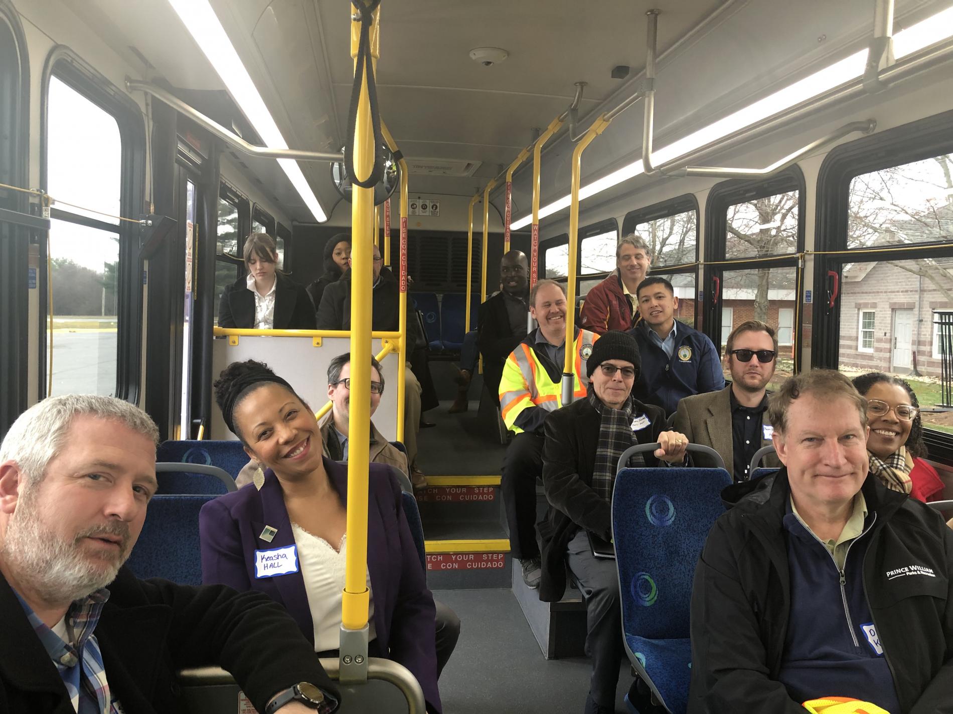
Week of 2/11/2024 – Foursquare ITP makes site visit to conduct Corridor Audit with stakeholders.
Week of 2/18/2024 – Corridor Audit snow day (If needed).
Week of 3/4/2024 or 3/11/2024 – Virtual Stakeholder meeting
3/15/2024 – PMT and Stakeholder Teams provide feedback on recommendations and evaluation framework.
4/15/2024 – PMT and Stakeholder Teams provide feedback on evaluation results.Image
- Task 4: Final Report
Completed
5/3/2024 – Foursquare ITP reviews and QA/QCs draft report and PowerPoint.
5/10/2024 – Project Management Team (PMT) Team receives draft report and PowerPoint.
5/24/2024 – PMT Team provides feedback draft report and PowerPoint.
5/31/2024 – Foursquare ITP shares final report and PowerPoint.
Related Transportation and Planning Studies
Expand all- Route 28 Bypass Project (Under Design Phase)
Route 28 traverses north/south in the center of Yorkshire. As the population in Northern Virginia continues to grow, traffic on Route 28 has increased dramatically.
The Prince William County Department of Transportation (PWC DOT) began initial studies in 2016 to identify and evaluate issues with congestion. Based on these preliminary studies, PWC DOT identified several possible solutions, and in September 2020, the Prince William Board of Supervisors approved a location, including budget endorsement on the Route 28 Bypass
Route 28 Corridor Feasibility (Completed)- The project goals for the Route 28 Corridor Feasibility Study are to identify infrastructure improvements that will improve travel times and network reliability within the Route 28 Corridor through Prince William County, the City of Manassas and the City of Manassas Park and develop a plan to implement the improvement projects. The purpose of the Route 28 Bypass study is to evaluate alternatives to relieve congestion on Route 28 (Nokesville Road/Center Street/Church Street/Centreville Road) through the City of Manassas, the City of Manassas Park, and Yorkshire area of Prince William County and select a preferred alternative to be included in the County’s long-range plans as well as based on VDOT's SMART Scale program to prioritize project.
Board Resolution 23-522 On October 10, 2023, the Board authorized PWC DOT to allow Modified 2A to be a design option, following a similar route but with an eastward turn to connect with existing Route 28 south of Bull Run. Both Alternative 2B and Modified 2A will be presented to the Board of County Supervisors for final design selection following public hearings.
- Prince William County 2040 Comprehensive PlanImage

Adopted on December 13, 2022, the Comprehensive Plan is the official statement of the County’s vision for land use and development pattern. The Land Use Chapter of the PWC 2040 Comprehensive Plan manages the timing, location, and characteristics of growth. It expresses the community’s aspirations and goals for the County’s future, while articulating a corresponding set of policies and recommendations, called action strategies, to guide future decisions regarding land use, development, and capital improvements.
Image
- Route 28 (Centreville Road) STARS Corridor Study: VDOTImage
 Image
Image
Initiated in July 2019, the VDOT STARS Route 28 Centreville Road recommended alternatives were developed in coordination with local partners and public input following two information meetings and online surveys in fall 2019. The study’s short and long-term alternatives assessed congestion, safety and pedestrian accommodations. Of the options presented in the meetings and surveys, the set of improvements identified to provide the most benefits include:
• Traffic signal timing optimization
• A new median along the corridor to improve safety
• A continuous sidewalk connection between the City of Manassas Park and Fairfax County
• Signalized pedestrian crosswalks at Browns Lane, Spruce Street, Leland Road, and Yorkshire Lane
• Restricted crossing U-Turn (RCUT) intersections at Browns Lane, Maplewood Drive, Leland Road and Orchard Bridge Drive
• A median U-turn (MUT) intersection at Yorkshire LaneCollectively, these improvements aim to reduce crashes along the corridor by 40-50%, reduce congestion by 15-20% and provide pedestrian accommodation.
The completion of this study sets the stage for proposed improvements that localities can pursue for funding for design and construction, and to consider including in their comprehensive plans. Please note that the study does not set schedules for design or construction. For more information, please review the following VDOT STARS Route 28 Centreville Road linkImage
About the VDOT STARS Program - Begun in 2007, the VDOT STARS Program objective is to develop comprehensive and innovative multimodal transportation solutions to address congestion and safety challenges. The goal was to support the development of affordable and short-range projects to address congestion bottlenecks and safety hotspots throughout the state. Recommendations from STARS studies included short- and mid-term operational and safety improvements and is part of how VDOT funds road project. Since 2012, the program has shifted focus to developing studies that can be programmed in the VDOT Six-year Program budget. Adapting to the need to find solutions to more complex congestion and safety challenges, STARS studies now include corridor studies and conceptual design plans. Transportation improvements identified are still targeting cost effective, innovative, and practical solutions, but also focus on ensuring the longevity of those improvements on the transportation network. Led by the Virginia Department of Transportation (VDOT), the program brings together planners, traffic engineers, environment specialists, roadway design engineers along with local stakeholders, to jointly identify cost-effective measures aimed at improving safety and reducing congestion.
• Develop innovative, cost-effective solutions.
• Evaluate potential solutions more thoroughly.
• Identify potential project risks and costs.
• Build stakeholder consensus.
• Improve readiness for project implementation.VDOT District offices can leverage Federal funding for State Planning and Research to help identify, plan, conceptually design, and ultimately program projects that reduce congestion and improve safety. STARS projects typically result in multiple recommended improvements that may be eligible for funding and implementation under maintenance budgets, applications in the SMART scale process, applications for the Virginia Highway Safety Improvements Program (VHSIP), State of Good Repair budgets, and/or applications for VDOT revenue sharing. The STARS project development process was created to provide a continuous pipeline of projects prepared for implementation. Many elements of the process are on an annual cycle; however, the conduct study and design phase will follow an appropriate schedule based on the nature and complexity of each STARS project. Advancement of STARS projects will be tracked as a measure of performance.
Questions or Comments?
- Email: [email protected]
- Submit the Planning Comment Form
All comments are subject to the Virginia Freedom of Information Act, including any personal information.
To receive automatic updates about general county government information, including Planning Office notifications, road closures, tax reminders, and other community information subscribe to PWC Alerts.

